 |
| The Northwest Angle border crossing is a tiny shed and a video phone |
Long ago when early cartographers were drawing the boundary
between the US and Canada, they didn’t always have a clear understanding of the
topography of the area. In fact, what the diplomats agreed upon in the Treaty of Paris (1783) was a geographic impossibility. They drew the
boundary through how they thought Lake of the Woods was situated, stranding a tiny section of the state of Minnesota across the lake in
Canada. It is above the 49th
parallel (49.3453° N, 95.0651° W), and is the northernmost most point in the Lower 48 States. You have to drive through Canada to get
there. So, we just had to visit!
 |
| Flat, flat, flat |
Lake of the Woods is a large lake, 37th largest in the
world. It is a huge fishing destination,
both in the summer and ice fishing in the winter. To get there we passed miles and miles of
flat farmland. Huge rectangular fields
stretching as far as you can see. You
can tell that something enormous (like a glacier) went through here and flattened
this land out. We stayed outside of the
town of Warroad in a fishing resort on the lake just 3 miles from the Canadian
border.
 |
| Entering Manitoba |
 |
| We moved from paved roads to dirt roads |
So, here is how we got to the Northwest Angle.
First, we had a nice chat with the Canadian
border officer who came aboard our motor home, then we crossed into Manitoba,
Canada.
This part of Manitoba is also
flat, flat, flat and has huge fields of crops.
After about 20 miles, the paved road ended,
and we drove along packed dirt roads.
There had been a heavy rain the night before, so the road was not too
dusty.
After a while, we turned into the
Northwest Angle Provincial Forest, and the roads became more rutted.
We bounced over washboard ridges and swerved
around deep holes in the road.
Eventually we came to the Manitoba/Minnesota border.
Signs told us that we should check in with
the US border folks at Jim’s Corner 14 miles down the road.
At this point the condition of the dirt road
improved.
 |
| Craziest border we've ever crossed. |
 |
| Yay, we've arrived! |
Jim’s Corner is a small hut.
There is a phone inside the hut and a phone outside the hut.
You push the button with an American flag
next to it.
US Border answers and you
tell them where you are, your vehicle license plate number, who you are, and
who is with you.
Yay, we had returned to
Minnesota.
 |
| Jim's Corner doubles for both US and Canada border crossings |
 |
| First you pick up the phone... |
 |
| ...and select if you are entering the US or Canada. |
The Northwest Angle has several small communities.
First, we headed to the Young's Bay Fishing
Resort.
We found that they had a
campground there.
We ate lunch at Jerry’s
restaurant.
Dana had a Minnesota
invented Juicy Lucy – a hamburger cooked with American cheese inside, and Swiss
cheese and grilled onions outside.
A
heart attack on a plate.
Yummy.
 |
| Young's Bay fishing resort |
 |
| A Juicy-Lucy - heart attack on a plate |
The resort is right on the shoreline of the lake. We noticed white pelicans floating in the
water. WHAT! We had hoped to see these beautiful birds in
the Everglades, but didn’t. They must
have already left for their trip up to Lake of the Woods. Oh yes, said the local folks, they are here
every summer.
 |
| White Pelicans on Lake of the Woods |
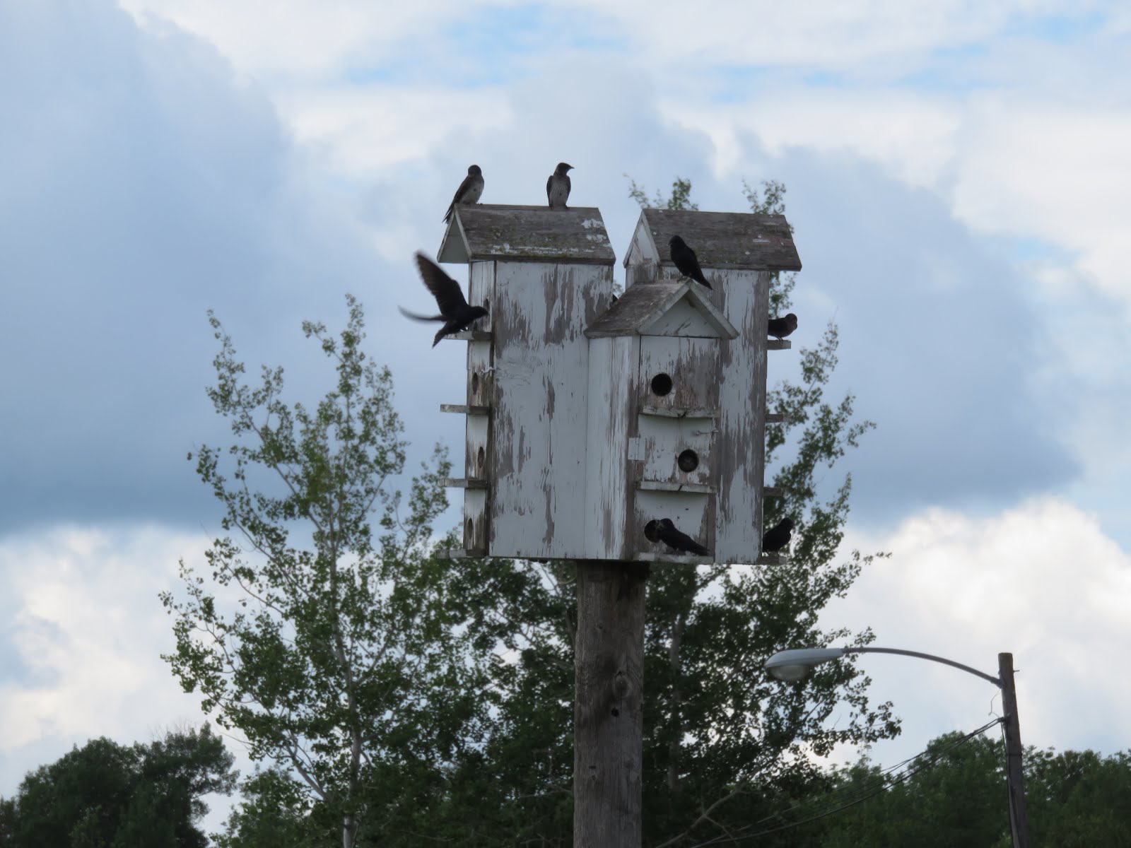
Everybody around Lake of the Woods has purple martin houses,
and Young's Bay had huge purple martin condominiums.
It was such a pleasure to have swarms of 20
or more purple martins flying overhead.
We just stood and watched them fly.
 |
| Purple Martins! |
We then drove over to Angle Inlet, the northernmost town in
the lower 48. We bought post cards and
mailed them at the northernmost post office.
Then we drove around the tiny town and saw the northernmost school, a
one-room, one-teacher K-6 school.
 |
| Most Northern Post Office |
Eventually, we returned to Jim’s Corner. This time we pushed the button with the
Canadian flag, as we were about to enter Canada. We repeated the same drill as before, though
this time they also wanted our home address.
Again bumping over the (now very dusty) rutted dirt road to the paved
road. At the US border, we gave our
passports to the border officer. We were
asked to pull to the side, where 2 more officers came out. One boarded the motor home while the other
stayed outside with us and Tiki. Thank
goodness we had left all of our fruits and vegetables in a cooler at the
campground before we left.
 |
| Kayaking on enormous Lake of the Woods |
The next day we took our kayaks out on the Lake. We had been warned that waves get very large
on the lake, especially at our location on the lake, because of the long miles
uninterrupted fetch across that portion of the lake. So, we decided to kayak along the
shoreline. We headed for a sandy beach
area around the island where we were staying.
The kayak to the beach was lovely.
It was fun to see the homes from the water. We landed at the beach and had a nice rest in
the sand leaning against our kayaks. The
wind picked up, and so did the waves. We
hugged the shore in shallow waters and had a strenuous paddle back. We joined fishing boats coming in to the
harbor. Too much wave action for
fishing, they said.
 |
| Some people just gotta swim in every body of water they visit... |
Our inflatable kayaks interested some of them, so after we
landed we had visitors to our campsite to get a closer look. The people that we met at this fishing resort
were extremely friendly. They dropped by
introduced themselves, and stayed for a chat.


No comments:
Post a Comment