Saturday, April 27, 2024

Crane Point Hammock Museum and Nature Trails - Marathon, Florida [April 23, 2023]


Endangered Florida Thatch Palms

Before settlers came to the Florida Keys there were areas of abundant hardwood forest, that are called “hammocks”.  63 acres of hammock containing rare and endangered trees and plants are preserved in the Crane Point Hammock Museum and Nature Trails.  


Calusa canoe

Native Calusa people were the first to use the area as a fish camp, and left some artifacts behind. 


Adderly House, the only tabby structure left in the Keys

The first permanent settlers were a Black Bahamian, George Adderly, and his wife Olivia who purchased 32 acres of Vaca Key for $100 and then built a tabby house in 1903.  Tabby is a kind of homemade cement made out of lime, created by burning wood and shells at high temperatures, mixed with sand and water.  Rocks and shells are put in to give it more mass.  The house is the oldest house in the Keys outside of Key West and the only tabby house remaining in the Keys.  The house has two main rooms and two bedrooms.

Adderly used this "creek" between Vaca and Rachel Keys to navigate to Florida Bay to havest sponges and to sail to Key West

Adderly collected sponges and made charcoal, and sailed his boat periodically to Key West to sell them and buy provisions that he and Olivia could not make on their own.  When the railroad came through, he negotiated a right of way that included a stop on Vaca Key, so he could use the railroad to travel to Key West more efficiently. 

This guy came to visit us at Adderly House.  We were told that racoons don't carry rabies in the Keys.


George Adderly was an Episcopal lay preacher who held services in his home.  At some point, a few other families built wooden houses near his on Vaca Key, forming Adderly Town.  All that remains of these homes are a few tools and household utensils found on the property.  

Built in the Bahamian style, every door or window has a corresponding opening on the other side for ventilation.


Olivia died in 1948 and George sold the property to the Crane family in 1949, moving to a home for the blind in Key West, where he died ten years later.


Crane House

Francis and Mary Crane were a Massachusetts couple who fled the New England winters, much as many “snow birds” do today.  They purchased Rachel Key in 1949.  When they purchased the adjoining Vaca Key from Adderly, they consolidated 63 acres of natural hammock.  The land was renamed Crane Point, and they built a house overlooking Florida Bay in 1954.


Crane Point (with old work boat)


The Cranes worked to preserve the special ecology and beauty of their wooded hammock.  All around their oasis, forests were being bulldozed in Marathon to make way for homes, hotels and businesses as more people discovered the Keys as a destination.


Beautiful hardwood hammock

In 1978,  the property was purchased by the newly formed Florida Land and Sea Trust to protect it from development.  The Crane Point Hammock Museum and Nature Trails has a natural history museum, the two historic houses, several miles of nature trails, and other educational and environmental activities.  Both the Adderly House and the Crane House are on the National Register of Historic Places.  You can walk through the Adderly House.  The Crane House has scheduled tours.


The museum has beautiful bronze doors

It was too windy to be out on the water, so we decided to head into Marathon to explore Crane Point, go grocery shopping and have lunch at a Cuban restaurant.  Crane Point has well maintained hiking trails that take you through the forest, past the historic houses, and along the point.  You can learn about interesting trees through signs along the way.


Black Mangrove "straw" roots snorkel up out of the water or mud to get oxygen

Crane Point is right off of Route 1 in the center of Marathon.  There is a shopping center with a grocery story directly across the street.  Marathon is a busy city at the north end of the 7-mile Bridge with an airport, hotels, time shares, condos, restaurants and businesses.


Dense foliage

After spending so much time on the edge of the ocean, it was really fun to have closer vistas of dense foliage, and the background songs of birds.  We love the stories of these kinds of parks, where individuals work to preserve a special, natural place. 


This huge spider built its' web across the trail!

Sunday, April 21, 2024

At Last! The Dry Tortugas National Park, Florida! [April 18, 2024]


Approaching Fort Jefferson 


7 tiny coral and sand keys 69 miles west of Key West, sitting by themselves at the entrance to the Gulf of Mexico were considered to be of such strategic importance that in 1846 the US Army started building what would become the largest brick structure in North America, Fort Jefferson.  Today, that fort and the surrounding keys and waters are protected as the Dry Tortugas National Park. 

Fish swimming outside the outer wall of the fort


We went to tour Fort Jefferson and to snorkel in the ocean waters along the outside of the fort to see the creatures that have taken up residence in the crevices along the masonry structure.


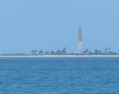
Fort Jefferson lighthouse

The Dry Tortugas were named "Los Tortugas" by the Spanish explorer Ponce De Leon who marked them on the nautical chart as being a location where mariners could find an important food source, green sea turtles.  Subsequent mariners added “Dry” to the name, because none of the keys have a source of fresh water. 


Lighthouse built on Loggerhead Key in 1857

These keys are at the end of a curved coral reef that extends south and west from Miami.  Ships sailing into or out of the Gulf of Mexico had to sail around them to avoid hitting the submerged reefs and sinking.  Also, the powerful Gulf Stream flows nearby that mariners used to assist them as they traveled up the East Coast and over to Europe.  Ships carrying goods that came down the Mississippi River to New Orleans for markets on the East Coast or Europe sailed right by these keys.  Also, ships bringing goods into New Orleans sailed past them as well.  They were a very strategic location.

The Sally Port is the only entrance/exit to the fort

The Dry Tortugas also provided natural deepwater harbors surrounded by shoals that US military ships patrolling these important shipping lanes could use to get supplies, make repairs or seek refuge during storms.


So many bricks

The army started building the enormous (16-acre) Fort Jefferson in 1846.  Everything that they needed to construct the fort had to be brought in by sailing vessel.  All that was there was saltwater, sand, coral and a few scrub trees.  Imagine the logistics of importing the 16 million bricks that were used, not to mention the special stone floors that withstood the force of cannons firing, or the cannons themselves.


Imagine unloading this huge cannon off a ship

The fort was designed to withstand a one-year siege.  An elaborate drainpipe system collected rain water from the fort’s top tier, filtering it through sand and collecting it into 109 cisterns located below the fort’s first level.  Over time, the cisterns were infiltrated with salt water, except for one 92,000-gallon cistern below the fort parade ground that is still in use today.

Intricate vaulting and brick work

During the Civil War, the fort was used as a prison for Union Army deserters.  It also housed four conspirators in the assassination of President Lincoln, including Dr. Samuel Mudd.

A moat surrounds the fort

The Army abandoned the fort in 1874.  The area became a wildlife refuge for a while, and then a National Monument.  In 1992, it became a National Park.


Part of the magnificent frigate bird welcoming party

In addition to the significant cultural heritage, the area is an important nesting area for masked boobys, sooty terns, brown noddys, and magnificent frigate birds.  When we arrived at the fort, the neighboring key, that was connected by a land bridge, was noisy with the calls of the nesting birds.  30 magnificent frigate birds glided silently overhead.


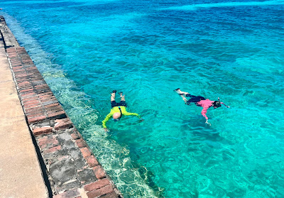
Snorkeling in the ocean outside the moat

Seargent majors


The fort has a moat around its 6 sides.  On 4 of these sides, the moat is surrounded by ocean.  You can snorkel along the outside of the moat wall.  Places where bricks have fallen out are now caves for fish and spiny lobsters to hide in.  The ocean floor is littered with brick and mortar debris that came out of the thick wall. 


Brain coral have colonized a masonry shelf

A colorful grunt fish


In one area, a whole vertical layer of brick work had fallen away, the resulting shelf was being colonized by brain coral and various soft coral species. 


We estimate this gigantic spiny lobster is over 2 feet long

These are BIG lobsters


We saw the largest spiny lobsters we have ever seen; they were easily over 2 feet long.  They live in protected waters in the park, so cannot be caught and eaten.  They live long, long lives.  Researchers have found that these giant lobsters are super breeders, with more offspring, and more offspring viable to survive.  It was an interesting study to learn about.  Especially when we saw how big they can grow.


The Yankee Freedom Ferry

The Dry Tortugas can only be reached by boat or sea plane.  You have to plan well in advance to visit there.  You can take the Yankee Freedom Ferry out of Key West, which takes only 175 lucky people there each day.  This is our 4th RV trip to the Florida Keys, and on each previous trip we were unable to get tickets on the ferry. 

Or you could charter a sea plane
 

This year, we made our reservations for tickets three-months in advance, in January.  If you don’t have tickets, you can arrive at the ferry terminal early to put your name on a waiting list in case someone who bought tickets does not show up.  On our trip, 2 people got on the ferry that way.  They had arrived at the terminal at 5:15 AM.


A view of the moat

We are camping 39 miles from Key West.  We left our campsite at 5:30 AM, dropped Schooner off at a pet sitter 3 keys down, and drove to Key West arriving at 6:30.  We parked at a garage a block away. 


Thick walls protect the Powder Magazine

You have to check in to the ferry by 7.  The ferry loads at 7:30 and departs at 8.  They provide you with a bagel breakfast, with fruit and juices.  [As a note, they provide alternative foods for visitors with dietary concerns, you just tell the crew member in the galley what you need.]


During part of the 2.5 hour trip, Hollywood (our tour guide) talked to us about the history of the park and what to expect while we were there.  We arrived at 10:30.  At 11:00, Hollywood gave a fascinating 30 minute orientation to the fort.  He also led a subsequent 1-hour tour of the fort.  Instead, we went back to the ferry to pick up a bag lunch, and ate our lunch in the fort courtyard and explored the fort on our own. 


At about 1:00, we went to the beach, and snorkeled for an hour or so.  Then we changed into dry clothes, and boarded the ferry for the ride back, departing at 3. We arrived back in Key West at 5:30, picked up Schooner and got back to our campsite at 7. 


The view from walking along the moat wall (yes, that's us).
Photo courtesy of Jeff and Didi Davis

The ferry loans snorkel gear for folks who do not bring their own.  Many of the people who did not wish to swim or snorkel, walked along the top of the moat walls, looking down at the sea creatures living in the moat, and also the animals we were seeing outside the moat as we snorkeled. 


It is was an amazing and exciting day.  Someone said to me that you have to be “intentional” to visit the Dry Tortugas, and you do.  You need to plan well ahead.  It is certainly worth the effort. 

We have finally visited Dry Tortugas National Park!


Tuesday, April 9, 2024

The Upper Florida Keys – Biscayne National Park and Key Largo, Florida [March 24 – 31, 2024]


When you think of the chain of Florida Keys, you think of Key Largo as the “First Key”, though it is actually just the first key you can drive to.  North of Key Largo are keys that are part of the chain, and that are protected as part of Biscayne National Park.


Biscayne National Park

Biscayne National Park is located just a few miles south of the Miami.  The park encompasses mangrove forests protecting the shoreline; the fertile sea grass beds of Biscayne Bay; a string of keys rich with plants, insects and birds; and coral reefs bright with colorful tropical fish.  95% of the park is water.  There are even a few ship wrecks thrown in as well.


Boardwalk along Biscayne Bay

You really need a boat to visit this beautiful national park.  We visited during Spring Break, and families had reserved all of the spots on the boat, snorkeling, and kayak tours that are offered by the Biscayne National Park Institute.  It was also too windy to launch our kayaks.  So, we enjoyed walking along the park nature trail/boardwalk along the edge of Biscayne Bay, and visiting the visitors center.


Green Heron hiding in the mangroves

We learned that an “island” is a body of land surrounded by water that is created by geological processes.  A “key” is a body of land surrounded by water that is created by biological processes.  Keys are ancient coral reefs exposed by a drop in sea level long ago. 


Cape Florida Lighthouse, Key Biscayne

Key Biscayne sits to the North of Biscayne Bay.  At the southern tip of Key Biscayne is Cape Florida and a beautiful lighthouse.  One day, we braved Miami traffic and drove to Key Biscayne.  History buffs might remember Key Biscayne was the location of President Nixon’s “Winter White House.”  You enter Key Biscayne from the north, driving first through Crandon Regional Park.  Bill Baggs Cape Florida State Park is on the southern part of the key.  Between the two parks is the tiny, lovely, ritzy town of Key Biscayne.


Everglades Alligator

Such a pretty smile...

We camped in the town of Homestead, Florida (history buffs might remember it from Hurricane Andrew).  Key Biscayne National Park is an 8-mile drive eastward from there through agricultural fields primarily growing nursery trees.  11 miles to the west is the entrance to Everglades National Park.  Given that it was too windy to be on the water, we made our third visit to the glorious Everglades, saw a wonderful Ranger Talk, and walked by a lazy alligator dozing in the sun alongside the path.  It is such a beautiful and immense “River of Grass”.  Always worth a visit.


River of Grass - The Everglades

30 miles or so to the south is Key Largo.  As you drive further along the Keys beyond Key Largo, toward Key West, the Keys become more natural and less populated.  Key Largo is the “First Key” and a very busy place.  John Pennekamp Coral Reef State Park in Key Largo protects the southern section of the same coral reef system as Key Biscayne National Park.  Once again, families on Spring Break crowded the State Park with lines of cars waiting along the highway to enter the park.  It was (again) too windy to kayak.  So, we had a leisurely few days, hung out at our lovely Bougainvillea-lined campsite, enjoyed the mild temperatures, swam in the campground pool, and rode our bicycles to lunch at a Cuban restaurant. 
 

Pretty, pretty campsite in Key Largo

When the winds finally diminished on Easter Sunday, we jumped on a snorkel tour boat for a lovely snorkel along a coral reef called Hen and Chickens.  We saw many of our favorite tropical fish.  Visibility was poor, so our photos are not really suitable for sharing.  Sorry. 


"Giant stride" entry to snorkel


We did see some of the “bleached coral” that we had heard about.  Tiny cells called zooxanthellae live with the coral polyps.  They help the polyps survive by providing food from photosynthesis.  The polyps in turn protect the zooxanthellae.  When sea water gets too hot, the zooxanthellae can die, and then the coral polyps die without them.  According to our snorkel boat First Mate, the water in the Keys got up to 100 degrees last summer, causing some of the zooxanthellae to perish.  The result is white sections on the coral heads where the polyps have died.  While we had seen photos of this phenomenon, it was tough to process seeing it “in person”.

White patches are "coral bleaching"

The water behind us is Biscayne National Park