Sunday, April 9, 2017

Visiting the White Pelicans at Padre Island National Seashore [April 4 and 6, 2017]

White Pelicans

Padre Island is 113 miles long and the longest barrier island in the world.  Padre Island National Seashore (Happy 101 B-day NPS!) protects 70 miles of the island. There are about 10 miles of roads, and if you are adventuresome and if you have a 4-wheel drive car, you can drive the length of the park.  It has pristine beaches and dunes along the Gulf of Mexico.  Laguna Madre separates the island from the Texas mainland. With only a few sources of water and high evaporation from the bright sun, Laguna Madre is hyper-saline, 1.5 to 3 times saltier than the ocean. 
Padre Island National Seashore's pristine beach along the Gulf of Mexico

Yes, you can drive on the beach - a good thing that Enterprise upgraded us to a Jeep

Padre Island is the next barrier island south of Mustang Island, so we were able to take day trips into the Seashore while we stayed at Mustang Island State Park.
Great view of Brown Pelicans

So many Brown Pelicans, to think they were once endangered due to DDT.

On our first trip, we spent time walking on the beach and exploring the different areas in the Park.  The beach here is even whiter, and the water even bluer than on neighboring Mustang Island, just 15 miles away.  The Bird Island Basin on Laguna Madre is shallow and considered one of the premier wind-surfing areas in the country.  Right near the wind-surfers was a sandbar with a group of rare White Pelicans.  Such a treat! 
White Pelicans sitting on a sand bar
Kayaking Laguna Madre - wind surfers dry camp on the shoreline in their RVs
Kayaking among the wind-surfers

It had been windy since we arrived in Texas 2 1/2 weeks before.  We finally had a day that was not as windy as the others, so we took a second trip to the Seashore to kayak on Laguna Madre and hopefully see more of the lovely White Pelicans.  The Laguna is a premier wind-surfing location, so we expected to encounter some wind, and we did.  None-the-less, we were very happy to be out on the water in our boats again. The White Pelicans were waiting for us, just where we had hoped to find them.
The tips of their wings are black - wing span 8 to 9.5 feet.  These are big birds!

Here they are up close, note the "centerboards" on their bills
The White Pelicans are much larger than the more commonly seen Brown Pelican.  The White is 62" long with an 8-9 1/2 foot wing span,  the Brown is only 50" long with a 6 1/2 foot wing span.  If you have been to a beach, you've likely seen the Brown Pelicans plunging into the water from great heights to grab a fish.  The White Pelicans scoop up their fish while they are swimming.   The Whites are magnificent to see in flight.   Breeding White Pelicans have the "centerboard" on the ridge of their bills.  Our Peterson Field Guide of Eastern Birds identifies Laguna Madre as their breeding range.


The arrow points to the location of Padre Island.


Friday, April 7, 2017

Mustang Island - Port Aransas, TX and Mustang Island State Park [March 30 – April 6, 2017]

Russ and Tiki in Port Aransas
Mustang Island is an 18-mile barrier island separating the Gulf of Mexico and Corpus Christi Bay.  The beach town of Port Aransas is on the north end of the island and lovely Mustang Island State Park is on the south end.
Loading onto the ferry


Historic Tarpon Inn
We arrived in Port Aransas by way of a short ferry ride from the mainland.  Port “A” is a cute beach town, primarily bars/restaurants and beach souvenir/gear shops.  We had a yummy Cajun low-country boil with crawfish, shrimp and crab at a restaurant named The Crazy Cajun.  Many visitors travel around town in rented gas powered golf carts.  We tooled around on our bicycles. Visitors to the historic Tarpon Inn (including FDR, and Duncan Hines [there really was a guy with that name!]) would write their names on huge scales from Tarpon fish that they had caught, and then hang the scales on the wall.
Lunch at the Crazy Cajun, note the FAU banner above our table.
Sunrise in Port Aransas

We stayed in a county-run park right on the beach.  In fact, for only $10 you can camp on the beach in your RV.  There were very high tides while we were there, so beach campers got their feet wet coming out of their rigs in the mornings.  
View from the Port Aransas jetty
Ship passing neighboring campsites


Shrimper leaving for the Gulf

The Port “A” beach sand is whiter in color than we’ve seen thus far in Texas, and the water a bluer color.  The park where we stayed is bordered by the jetty and the canal used by ocean going ships to enter Corpus Christi Bay.  Yay, more big ships!!!!  

One of the things we like about the Texas Gulf Coast is that dogs are allowed on the beach.  With two fetching/swimming walks a day, Tiki is definitely a happy camper here.
UT Austin Marine Science Education Center
One of the sights on the walking tour at the Marine Science Education Center

The University of Texas at Austin Marine Science campus is located in Port Aransas.  They have a really nice exhibit area about estuaries and an outside walking tour of different eco-systems along the Texas coastline.  One thing that we learned is that the water currents that go past the northern Texas beaches come from Louisiana and the mouth of the Mississippi. Could that be why the waters and beaches are brown?  Another current comes up from the Gulf Stream by Cuba toward Mustang Island.  Could that be why the water seems so much clearer here?
Mustang Island State Park beach

Sunset over the grasslands
1 or 6 oil rigs off-shore from Mustang Island State Park

After 3 days in Port “A”, we drove a whopping 15 miles south to Mustang Island State Park for 5 more days.  What a beautiful park!  The crazy winds that we’ve had with us since arriving in Galveston persisted, so the only ShoreXplorer to go swimming was Tiki, but it is a lovely, lovely white beach to walk along next to blue water.  The dunes here are quite high with several bands of dunes separating the Gulf from the interior of the island.  The rest of the narrow island is very flat, and covered in grasslands.  

One of these things is not like the other...

Wednesday, April 5, 2017

The Museum by the Bay - USS Lexington and Corpus Christi, Texas [April 3, 2017]


Russ on the USS Lexington Flight Deck


The retired USS Lexington aircraft carrier floats in the emerald green waters of Corpus Christi Bay, open to the public and teaching us what it was like to serve on this floating city.  You clamber up and down the ladders used to move from one level to another.  You can see the captain and crew quarters, stand on the bridge, and sit in a pilots briefing room.  You can walk along the flight deck, and touch and see vintage aircraft. There is a 20-minute 3-D movie about the history of naval warfare, and the importance of a strong navy to prevent future wars. It really is very interesting. 
Dana on the Bridge, boy is it crowded...

Pilots' Briefing Room
The Lexington from a distance

Some of the displays are a little old fashioned, but it is clear that this aircraft carrier is being cared for and displayed with great affection and with an eye to the opportunity to educate we landlubbers about life aboard a carrier and about WWII.  The USS Lexington was commissioned in 1943 and retired in 1991, as the oldest working aircraft carrier.  During WWII it served in the Pacific theater where it was nicknamed the Blue Ghost by the Japanese because it was reported by them as sunk 4 times only to return each time.  The last 29 years of its service was as a Naval Training Vessel.  

Downtown Corpus Christi

Corpus Christi is a crescent shaped small city along the shores of lovely Corpus Christi Bay.  When compared by tonnage, Corpus Christi is the 5th largest international deep-water port in the US.  We saw a huge tanker escorted into port by 3 tug boats, and then saw the tugs maneuver the tanker against the pier.  We also saw billowing black smoke and flames where a refinery mishap was being directed out two chimneys.
Corpus Christi Sea Wall


Downtown Corpus Christi has an interesting sea wall that is stair-stepped down from the road to the water.  It was designed to join the vistas of the city and the Bay by Gutzon Borglum, sculptor of Mount Rushmore.  It really is quite pretty and unique.  We returned to our campground by way of Ocean Blvd, passing attractive Spanish-style homes that overlook the water.  We liked Corpus.  It almost felt like Southern California, very laid back, and very appreciative of its natural surroundings.
This is what it looks like when an egret fishes off of a sea wall...

Saturday, April 1, 2017

A Tiny Town Dwarfed by an Industrial Plant – Quintana TX [March 27 – 29, 2017]


In this part of the world (coastal Louisiana and Texas), it is almost impossible to forget about the enormous presence of the petrochemical industry.  The gas that fuels our cars and the Liquefied Natural Gas (LNG) that heats our homes and warms our ovens may have come out of the ground here.  Huge oil rigs are smudges on the horizon out in the Gulf of Mexico, their lights visible on a dark night.  Oil wells pump up and down in fields as cattle placidly graze around them.  Even touristy Galveston Harbor has oil drilling equipment along the industrial shoreline opposite the museums and historic tall ships.
Quintana Beach County Park

However, nothing prepared us for what we encountered in tiny Quintana, Texas.  Wikipedia (the source for all “accurate” information) says that Quintana has 20 homes.  That may be off by 50%, but it is still a tiny town.  It has no shops.  It has no post office.  What it does have is a delightful county park on the shoreline of the Gulf of Mexico near where the Brazos River enters the Gulf.  The park is spacious and green, with lovely dunes and a beach complete with little palm roofed structures to provide shade. 
Our motor home is to the right.


The other thing that it has is an enormous petrochemical plant that processes LNG.  So, when we came out of our camper and looked in one direction we saw a lovely natural setting.  When we looked in the other direction we saw an industrial landscape.  You can imagine which way we chose to look.


The Brazos River has a deep-water port, so huge tankers and other ocean going vessels came past our jetty and beach.  If you have been following this blog for a while, you know that we LOVE big ships.  It was fascinating to watch them glide past the beach.  We could even see them from our windows as they passed alongside the LNG plant!
Male Great-tailed Grackle

Female Great-tailed

While we have been in Texas, we have been serenaded by the raucous calls of “nesting” Boat-tailed and Great-tailed Grackles.  They are larger than the grackles back home and have very long tails that can fan up at the sides forming a “V” like the keel of a boat.  The Great-tailed are a bit larger than the Boat-tailed and can be found around all of Texas.  The Boat-tailed are only found along the Gulf Coast and in all of Florida.  They chirp, cluck, croak, and sing.  They have a very high pitched wail that sounds like an emergency siren in the distance.  They start the noise at sunrise and quiet down at sunset.  In Quintana, they walked around on the roof of our motor home.  It sounded like demented entertainers tap dancing on our roof.

Pelicans!!!

Wednesday, March 29, 2017

Galveston, oh, Galveston – Galveston, TX [March 22-26, 2017]

On the beach at Galveston, Texas!!!

Galveston is an island, a town, a bay, and an “island time” state of mind.  It is a welcoming beach town; less schlocky and cleaner than most of the big beach towns we have visited.  It has a really interesting history, and resides next to a very industrial, petrochemical presence on neighboring islands and coastlines around Galveston Bay.
Tiki, after a swim


Portugese-Man-of-War jellyfish.

We started our stay at the beach, natch!  Our campground adjoined Stewart Beach, a wide, long public beach that was relatively empty on weekdays and wall-to-wall people on the weekend.  The sand here is very fine, powdery, brown sand.  The slope of the beach is very shallow, and the water is very shallow for a long way off the beach.  Consequently, there is a long area of waves off from the shore.  The water turns a muddy brown color as the waves pick up the fine brown sand.  It was warm and windy while we were there, warm enough to wear shorts but too windy for us to swim comfortably.  Tiki was not bothered by the wind, and swam every morning on our morning walks.
Part of The Strand

These deep curbs allow for run-off during big storms.

You may have heard about the 1900 Galveston Hurricane, described in the 2000 best-selling book Isaac’s Storm by Erik Larson.  This tragic storm flooded the island, washed away most of the buildings and killed thousands of people.  It is still the greatest U.S. natural disaster of all time, even worse than Katrina. At the time, Galveston was Texas’ most prominent deep water port.  It was an international port of trade and an entry point for immigrants.  The town had great wealth.  After the storm, the town built a seawall to protect it, and raised the elevation of the town by several feet.  However, it never returned to its former wealth and stature as a great port city.  Neighboring Houston took most of that traffic and prestige.  A few of the sturdiest stone buildings from that time remain.  Some of the others are in the old commercial district called The Strand.  Eight years ago, Galveston took a direct hit with Hurricane Ike and most of the homes were inundated with feet of water.  However, the seawall held, and more modern emergency procedures were followed, and the town did not repeat the tragedy of the 1900 storm.
The Bishop's Palace
Inside the Bishop's Palace

We visited the Bishop's Palace, an ornate Victorian home completed in 1893 for the wealthy Gresham family and used for 40 years starting in 1923 as the residence of the Catholic Bishop of Galveston.  It is one of the few buildings to survive the 1900 Hurricane.  The house is beautiful, full of amazing wood floors, marble fireplaces, and tall windows, some of them stained glass.

Oil rig museum - the Ocean Star


This is used to transport workers from the rig to a boat to return to shore and vice versa.


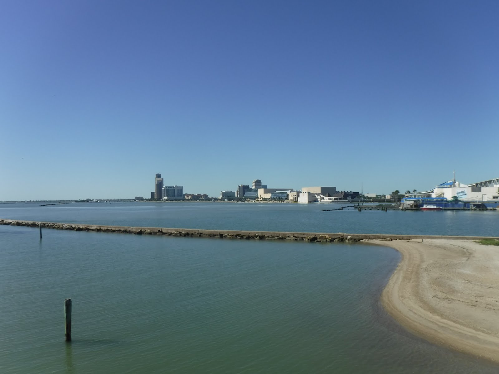
Oil drilling stuff across Galveston Harbor from the Ocean Star

We also visited a retired oil rig that has been set up in Galveston harbor as a museum about the offshore oil drilling industry.  We learned many things about the different kinds of rigs, and the different ways that the oil is transported from the well to the mainland for processing and distribution.  The museum unabashedly promotes the interests of the petrochemical industries.  None-the-less, it was kind of cool to be moving around on a real oil rig, and going out on the decks.
The Historic Galveston Pleasure Pier


On the Ferris Wheel


View across the island from the Ferris Wheel - do you see the cruise ship in the harbor?

Galveston is working hard to make itself a desirable beach destination.  They are renewing some of the beaches with sand pumped from a sandbar out in the Gulf.  They have a convention center and have attracted well-known restaurants to the island to supplement the local restaurants.  They also restored the Historic Galveston Pleasure Pier with amusement park rides and activities on the pier out over the water.  We rode the Ferris Wheel and had a gorgeous view of the coastline and the town.
White pelicans in Galveston Harbor - the last time we saw these guys was in the Northwest Angle of Minnesota in July.
We spent most of our time in the more developed northern part of the island.  As we were leaving, we followed the island south, stopping to have lunch at lovely Galveston Island State Park.