Tuesday, April 5, 2022

Biking and Kayaking a Gem of an Island – St. George Island [March 10-27, 2022]

Oystercatchers doing their thing on an exposed oyster bar


The crown jewel of the Forgotten Coast is St. George Island, and the most gorgeous part of the island is the St. George Island State Park.  We visited the island four times. 


Wild and natural St. George Island State Park Beach

The Forgotten Coast has two other barrier islands in addition to St George. St. Vincent Island can only be reached by boat and is a wildlife preserve.  Dog Island, also only reached by boat, has some vacation homes on it. 


Walking out one of the beach access points near the vacation rentals

St. George Island is 22 miles long and is reached by a 4 ½ mile bridge.  The center 6 blocks of the island is what passes for a tourist center here – 1 big swimwear store, a 
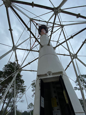
handful of two story motels, the lighthouse (see previous post), restaurants, ice cream shops, a kayak/paddleboard/bicycle rental shop.  The rest of the island is an eclectic assortment of vacation rental homes and condos, with quite a few still undeveloped lots.  It has lovely, uncrowded white sand beaches along the green waters of the Gulf of Mexico.  The west end of the island is a gated community and the east end is St. George Island State Park.


Naturally formed sand dunes

We drove out to the island in between rain storms on our first full day on the Forgotten Coast.  We drove through the park, figuring out where the bath houses and boat ramps were located.  The small campground, nestled in a pine and palmetto forest, is very popular and hard to book a spot in.


Sanded in bike trail

On our next visit, we took our bicycles and biked around the park.  It was a very windy day, so the park was not busy with beach visitors.  The park has many scenic, natural dunes.  Unlike the human-assisted dunes of the NC Outer Banks that make a straight line barrier between houses and the sea, these dunes are uneven; forming in groups, some tall and some short.  There is a bike/hiking trail through the last undeveloped miles of the park to the point of the island.  However, Hurricane Michael deposited a lot of sand over the trail, making it impossible for us to ride.  Guess we’ll need to return and hike it some day.


The motor home bike rack didn't fit out little car so well

This was our first trip carrying the bikes on the new trailer hitch/bike rack on our little Ford Fiesta tow car.  We used the sturdy Thule bike rack we use to carry our bikes on the motor home.  It wasn't the right fit for our tiny car.  After this one use, we ordered a bike rack in a different format that works better.  So, we are now traveling with 2 bike racks – one on the motorhome and one on the tow car.


The Bay side of the island

On our next visit, we explored the western part of the island, before you get to the gated community.  It was another windy day.  The houses on the Gulf side seem to be primarily vacation rentals with cute ocean-related house names.  The houses on the Bay side seem to be for the permanent residents.  The roads on that side are packed sand, not paved, and many of the yards around the houses are lush with green vegetation. 


Our tricked out tow car

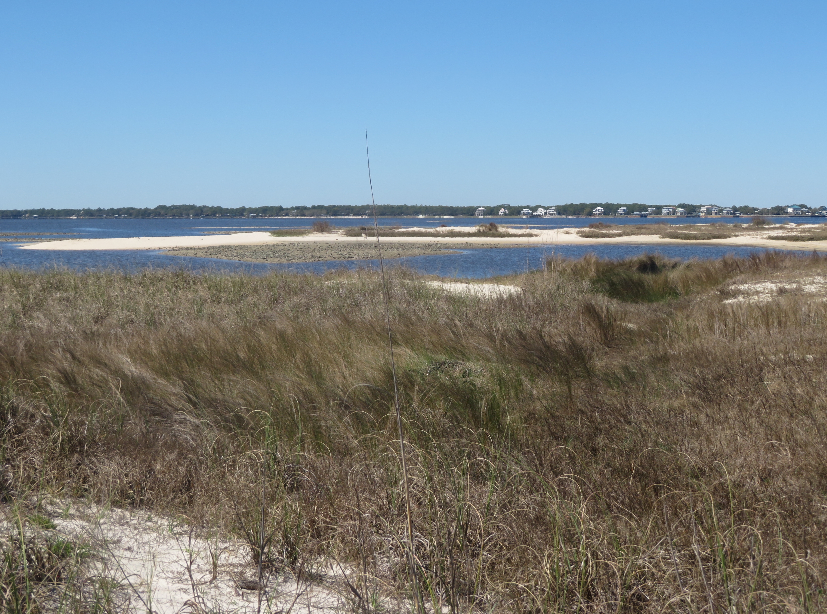
The state park is shaped like a fishing hook, and the body of water in the center is called the East Slough.  We took our kayaks to the park on our new roof rack kayak carriers, another modification to the little Fiesta.  

Kayaking the East Slough on a calm day


The winds were calm when we shoved off.  We drifted along the edge of the slough looking at dunes that had been cordoned off as shorebird nesting areas, and at wetland grasses.  We watched two 
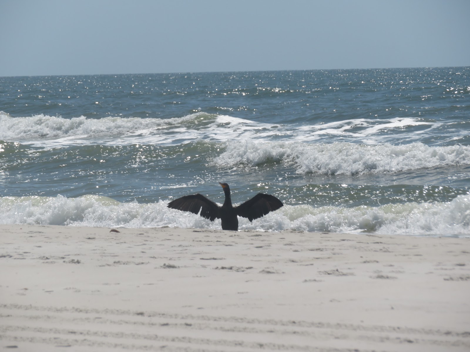
Oystercatcher birds pecking along an oyster bar that had been exposed by the low tide.  They were so interesting to watch, and they let us stay for about 15 minutes before they flew away. 


Oystercatcher


It was so peaceful with the occasional fish jumping and sun sparkling on the water.  We paddled to the end of the slough and headed back on the opposite shore.   At this point the wind had come up, and we were paddling against the wind and also the incoming tide.  Up ahead we noticed a commotion in the water, so we crossed back over the slough to get away from it.  There was a lot of thrashing, splashing, tails and fins as a large animal fed on the fish in shallow water.  The predator and prey continued down the other side of the slough quite a ways away from us as we paddled back to the boat ramp. We were unsure the predator was a shark or a dolphin, we couldn’t tell from a distance and the action was happening quickly.  We took a video that was zoomed in.  When we watched it later, we saw that it was a bottlenose dolphin.  So dramatic.


Kayaking off of our beach in Apalachicola Bay

This was our second kayak paddle on the Forgotten Coast.  We had paddled the week before from off of Carrabelle Beach.  It was fun to see the coastline from a different vantagepoint.  Winds and currents eventually drove us back to shore.


Red Flag day at the beach

On each of our visits to St. George Island, we spent some time on the beach.  The miles of beach are covered with a fine white sand.  There are a lot of shells.  Sadly, most times we were there, the winds were so high that it was unsafe to swim - red flag days.  Another reason to return!

Happy kayakers!


Thursday, March 24, 2022

Two Lighthouses and Other Things to Do on the Forgotten Coast [March 18-21, 2022]


Cape St George Lighthouse and Keepers House


Cape St. George Lighthouse

The stories of Florida lighthouses often include tales about when they were rebuilt after being knocked down in a hurricane, and this one located on St. George Island is no exception. Originally built in 1833, this lighthouse collapsed and was moved inland and rebuilt 3 times before beach erosion caused the last one to fall down in October 2005.  Volunteers chipped mortar off of 22,000 original 19th century bricks which were used to rebuild the current lighthouse using the original plans.  This lighthouse opened to the public in 2008.

St, George Island is one of the 3 barrier islands that are part of the Forgotten Coast.  The rebuilt lighthouse now stands with a replica Lighthouse Keeper House at the center of the island at the end of the bridge used to access the island.  The house can be visited for free, and you can climb the lighthouse for $5.

At the base the walls are 4 feet thick

Somewhere along the line, the cast-iron stairs that wound their way up through the center of the lighthouse got destroyed.  Now, lovely wooden stairs wind their way along a central wooden post up the lighthouse.  This is a unique experience for veteran lighthouse climbers.  With open cast-iron stairs you can look up at where you are going and also look down at the floor of the lighthouse.  On the wooden stairs, we did not experience any of the feeling you can get of floating in space with the open cast-iron stairs. 

The bridge to the mainland as seen from the lighthouse.

Looking down St. George Island

The last part of the climb is a 9 rung ladder and a narrow opening that you squeeze your way through to get to the top.  The view is magnificent, and well worth the climb.


From the historical display.  This tilt was "fixed" but eventually the beach eroded and the lighthouse collapsed.

Crooked River Lighthouse

The Crooked River Lighthouse

On the mainland, the Crooked River Lighthouse and replica Lighthouse Keepers House are located in Carrabelle Beach, just a short bike ride from our campground.  This lighthouse was originally built on another barrier island, Dog Island, which can only be reached by boat.

Keepers House

In the 1800s, Apalachicola had prosperous shipping industries in cotton and oysters, which necessitated the need for navigational aids through the barrier islands and construction of lighthouses on St. George and Dog Islands.  The lighthouse on Dog Island was destroyed three times by storms before the decision was made in 1895 to move it to the mainland and to build it from steel instead of brick.

Looking up


The climb

The 103-foot iron and steel structure is open to the public and you can climb it for $5.  We did not climb the lighthouse, but did peer in to look up inside it. 

2-sided Fresnel Lens from the front

And from the back

The lighthouse had an interesting 2-sided Fresnel lens displayed in the lighthouse keepers house, that was repatriated in 2021 from where it had been displayed in a Coast Guard museum elsewhere.  Most lighthouse lenses are round, because they display signals in a circle.  This one, just signaled from the mainland out to sea, so only required 1/2 of the lens.  Very ingenious.


Camp Gordon Johnston WWII Museum


The Forgotten Coast was home to the WWII Camp Gordon Johnston US Army 4th Infantry Amphibious Training Center.  Amphibious troops trained for D-Day and for landings on Pacific islands here.  The beaches along the coastline and St George and Dog Islands were used for the training exercises.  Life in the base was hot, buggy and generally unpleasant. 

This local history museum lovingly collects and displays memorabilia from Camp Gordon Johnston, WWII in general, and other conflicts.  Many people who served at the camp have donated uniforms, canteens, medical materials, and other artifacts to the museum.  There are some very interesting information panels explaining the history of the camp, and a few videos.  One is a fascinating newsreel from the 1940s about the camp showing the training exercises.


Apalachicola National Estuarine Research Reserve (ANERR) 

Nature Center and Hikes

The Apalachicola National Estuarine Research Reserve studies and preserves the Apalachicola estuary system.  It has a lovely Nature Center and informational hikes. 

The National Estuarine Research Reserve System is a network of 30 coastal sites in the US managed in partnership between NOAA and the coastal states.  They study the unique plant and animal communities that live in the bodies of water where the rivers meet the sea. 

The Apalachicola River is a watershed of 19,600 square miles including the Apalachicola River in Florida, and the Chattahoochee and Flint Rivers that flow into it from Georgia and Alabama.

The Nature Center focuses on teaching visitors about estuaries with bright, attractive displays and large aquarium tanks with fish and other creatures.  There is a child focused hands-on specimen study area.  We found the displays about the history of the area and a small display about the turpentine industry that harvested sap from local pine trees very interesting.

The boardwalk tour that we took described the dams, power plants and other man made obstructions that drops of water would encounter as they traveled along the rivers within the estuary system.  The walk ends, of course, as you come through a forested area to a beach overlooking the Apalachicola Bay.  Very effective and informational.

Sadly, we were so engrossed in what we were learning, we didn’t take any photos.  Sorry folks!


Monday, March 21, 2022

St Joe After the Hurricane - St. Joseph Peninsula State Park [March 16, 2022]


In October 2018, the eye of Hurricane Michael roared ashore just a few miles from St. Joseph Peninsula State Park in Florida.  The Category 5 storm had 160 mph sustained winds and was the most powerful storm to hit the Florida panhandle, ever.  It was the fourth strongest hurricane to impact the US mainland.  It literally blew parts of this wonderful state park away.  Campgrounds, hiking trails, roads, park buildings - all gone.  The storm dug out a canal across the peninsula, turning the northern part of the park into an island. Over the years, the watery breach has filled in with sand, and just last week (3 ½ years later) they started rebuilding the damaged areas.


We have visited St Joe State Park several times.  The campground of this immensely popular park was always fully booked, so it was a treat to be able to stay for 2 or 3 nights.  We loved the long white beaches, gorgeous rugged sand dunes and campsites nestled in pine and palmetto forest.  We had heard about the Forgotten Coast for the first time while staying at St. Joe.  It is a little more than a one hour drive away from where we are staying in Carrabelle, so we decided to see what is left of the park.


To get to the park, you drive through an area known as Cape San Blas.  Most of the houses along the road and beach looked new.  It looked like they had either been rebuilt or at least had new siding put on them. There were a bunch of structures still under construction.  At the park entrance, you see huge stands of dead pine trees, all broken off at the same height.  We saw similar tree damage on the Mississippi coast after Hurricane Katrina.


The first mile of the park is open up to the boat dock and store, with two beach access points and a bath house.  After that, there is a barrier across the road.  The beach is still gorgeous, white, and wide.  They have worked to reconstruct the dunes to protect the interior of the peninsula.  With the breach filled in, you again have 9 miles of continuous beach to enjoy, with discrete signs telling you to keep off the dunes.


We took a long walk up the beach, trying to peer over the dunes and figure out where the campgrounds might have been.  We stopped and enjoyed the gorgeous water and sand, sitting away from the beach access points and the people congregated there.  After a while we were joined by a cormorant drying its wings in the breeze.  We’d never seen a cormorant doing this task on the beach, we have always seen them perched on a piling or branch.


St. Joseph Peninsula State Park is still one of the most beautiful state parks we’ve visited.  We can’t wait to return to the newly built sections of the park.


If you'd like to see St Joe as it once was, here are links to our blog posts from our previous visits.

2014

http://shorexplorers.blogspot.com/2014/04/a-perfect-beach-day-on-perfect-beach-st.html

http://shorexplorers.blogspot.com/2014/04/sunset-st-joseph-peninsula-state-park.html

2017

http://shorexplorers.blogspot.com/2017/10/return-to-st-joe-florida-october-1-6.html


Saturday, March 19, 2022

Discovering Florida’s Forgotten Coast – Carrabelle Beach, Florida [March 9-29, 2022]

Carrabelle Beach, Florida

Between the towns of Apalachicola and Alligator Point, Florida is the relatively undeveloped section of the Panhandle self-named the Forgotten Coast.  You won’t find high rise hotels, chain restaurants, tourist attractions or traffic here.  You will find gorgeous white sand beaches, 3 barrier islands, stretches of undeveloped National and State Forests, 2 lighthouses, local businesses, and kind, warm-hearted people.  They say that the Forgotten Coast encompasses 250 miles of beaches.  


We are camping in Carrabelle Beach, centrally located along the Forgotten Coast.  There is a gorgeous beach along Apalachicola Bay across Highway 98 from our campground.  Next to the beach is a public beach access area with concrete shelters and picnic tables painted faded turquoise and pink.  On the sunny weekend days, the shelters were busy but there was still plenty of room on the beach.


One day, high winds blew the water away from the shore, exposing the sea floor and many, many stranded starfish.  In one puddle that was left behind, we found tiny, live coquinas.  Coquina shells are ubiquitous on the Gulf Coast beaches, but we had never seen the creatures that inhabit the shells, themselves. 


Russ' lunch at the Up the Creek restaurant in Apalachicola

Oysters are big business here. Can you see the birds scavenging the meat left on the shells>

Some of Apalachicola's Shrimp Fleet

Apalachicola is an historic town with prosperous fisheries industries.  It has wide, tree-lined streets and huge historic homes with deep, shadowed verandahs.  Some of the homes are now open as museums, and some of them have been converted to inns.  The downtown area has cute shops and seafood restaurants.  We went to Apalachicola for the Saturday Farmers Market.  It was canceled because torrential rains on Friday had flooded the market area.  So, instead we strolled along the working wharf and admired the shrimping fleet.  Later we had lunch at Up the Creek overlooking the Apalachicola River.  Grilled Oysters and Steamed Shrimp for Russ, Grilled Shrimp Po Boy for Dana.


Bald Point State Park has a steep beach!

Do you think this might be why they call it Bald Point?

There are 5 State Parks about one hours drive from Carrabelle.  The point of land at the intersection of Ochlockonee Bay and Apalachee Bay near Alligator Point has been preserved as Bald Point State Park.  The interior of the park is wetland with low-growing vegetation, which may be why the point looks “bald”.  Unlike most of this area, the beaches here are very steep.  We shared our beach walk with a swallow and 2 other people.  Horseshoe crabs breed in this area, and they have a program identifying some of them by number, tracking their migration patterns.


A benefit of Daylight Saving Time is that it is easier to see the sunrise.

This is a different way to travel for us.  We will stay in Carrabelle for a total of 3 weeks.  Instead of pulling up stakes and traveling to a new location every few days, we are settled in and taking the time to get to know the area well. 


Tiki as we like to remember her - wet, happy, and with a ball in her mouth.

Another difference from other trips is that there are just two of us traveling on this jaunt.  We said good-bye to our beloved companion and fellow-explorer Tiki just days before our departure.  She was 14 ½ and very ill.  It feels a bit lonely not to have her running along the beach with us, barking at us to throw something in the water for her to retrieve.

Early morning on the beach.

Tuesday, October 12, 2021

Bodie Light, Surf, Sound, and other things OBX – Rodanthe NC [Fall 2021]


Bodie light on a misty day

It has been 19 months since our last blog post, and here we are on the Outer Banks of North Carolina!


Bodie lighthouse sits next to a freshwater marsh

Today we went to visit the Bodie Lighthouse, North of Oregon Inlet and Hatteras Island, where we are staying.  The Bodie Light has distinctive horizontal black and white markings and a light that can be seen 19 miles out to sea.  It warns southbound ships that are riding the Labrador Current that they need to move further out to sea to avoid the constantly changing shoals off these barrier islands, and also avoid the area (a few miles South) where the Labrador Current and the Gulf Stream intersect.  The more famous Hatteras Light similarly warns northbound ships.  This area is known as the Graveyard of the Atlantic for good reason.


Sadly, we didn't get to climb to the top

We arrived at the lighthouse just in time for a Ranger Talk about the light, but (sadly) the day after the lighthouse was closed for climbing.  This is actually the third lighthouse built in this area.  The first one developed a prominent lean and had to be taken down.  The second one was destroyed by the Confederate soldiers who were concerned it might fall into Union hands.  This one was built in 1872, and still uses its original 1st-order Fresnel lens.  It was originally fueled with pig lard, then kerosene, then electricity.


Calm September sunrise
Easy swimming

We came to  Rodanthe/Waves/Salvo in mid-September for our first adventure on our own since the world changed in March 2020.  We liked it so much, we returned in mid-October, the next time our schedules permitted.  The tri-village area is much less developed, and therefore less crowded, than the towns further north. It hosts 5 campgrounds – 3 along the ocean.  September was our third trip to this area since we started traveling, and we stayed at our third campground, Camp Hatteras.  All of the campgrounds are very nice.  Camp Hatteras has campsites on both the ocean side of Hwy 12 and the “Sound” side.  It has a boat launch into the Pamlico Sound for our kayaks.  So we are back here again in October.


Angry October seas

When we were here in September, the weather was bright and hot.  We swam in a calm ocean and walked along the beach.  We had several kayak paddles in the Sound, surprising pelicans and admiring the vast expanses of calm, shallow water.  You can’t see the other shoreline of the Sound from here.  In October, we have encountered high winds, and often torrential rain.  On calmer days, it feels like we are sitting inside of a low cloud with moisture leaking out of the mists.  You can't really call it rain...  The ocean has been magnificent in its fury, though our beach walks are certainly shorter.  We’ve played cards, read books, watched movies, taken naps.  Experiences just as lovely as the swimming, kayaking and biking of our September visit.


We met a crab...

... and some pelicans


Where have we been the past 19 months?  Home, mostly.  We’ve taken the motorhome to Tennessee a few times and more recently to Minnesota to see family members.  It is easy to keep socially distant when you carry your own kitchen, bedroom and bath with you.  We’ve missed being out on the road, and we’ve been told that some of you miss hearing from us in our blogs.  Is it time to start both up again…?